 Chepstow
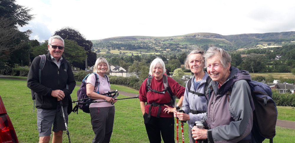
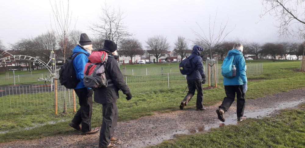
 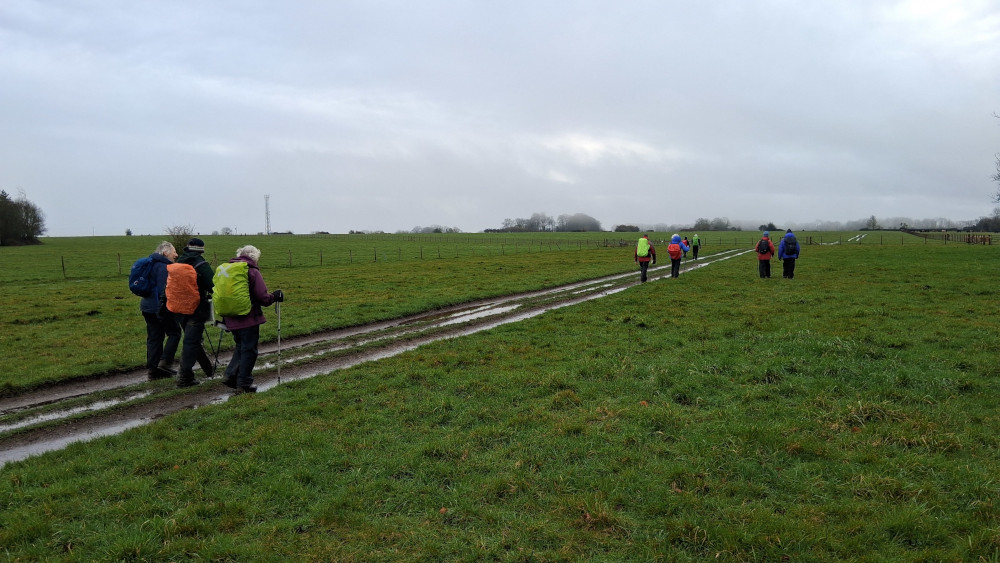 After what felt like (and probably was) months of rain, a hardy group of 10 assembled at a convenient lay-by just off the A46 near Upper Swainswick.
We set off, in the rain, heading north on a private road/bridleway and then a public footpath which gradually climbed to reach the edge of the former Charmey Down Airfield, close to what was probably the control tower (now rather derelict and unloved).
We continued in a NW direction, gradually dropping down and then turning E to descend more steeply over waterlogged ground to reach Monkswood Reservoir where we found a little shelter from the rain for a coffee stop under dripping trees.
At the eastern end of the reservoir, we joined a minor road a turned right to climb steeply before leaving the road on a sharp bend a continue climbing S on a muddy path steeply up the hill back towards the airfield. We then crossed the middle of the airfield (N to S) passing a small memorial stone (which not everyone noticed) before stopping in a brief moment of sunshine for lunch.
After lunch we continued in a southerly direction to Charmydown Farm and thence on to a path down some steeper, wetter and more overgrown hillside and onto a narrow 'nose' overlooking Ramscombe Bottom. We then crossed a small, but slippery, footbridge over a rapidly flowing stream at the lowest point of our walk.
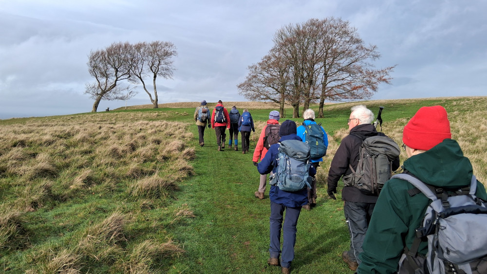
After an initial climb, the path levelled out a little before reaching a small lane where we turned right and after 150m we took another public footpath to the left which climbed and zig-zagged on its way up towards Little Solisbury Hill - the final section being quite steep with a choice of slippery mud, slippery stones, or slippery grass to reach the plateau top. We then passed another small memorial stone on our way to the trig point where we had extensive views out towards Bath, wind was blowing, time stood still.
As the skies continued to clear, we stayed on the 'Circuit of Bath' path as it descended from the plateau through some muddy puddles (being enjoyed by some bouncy dogs - hopefully the muddy footprints on the waterproof trousers will easily wash off) before reaching a grassy, if wet, field - which gave a final chance to clean our boots before returning to the private road leading us back to the cars in our now almost dry waterproofs.
Just over 12km, with about 400m ascent in roughly 6 hours (including stops).
 Walking from the slightly remote Warden's Wood Car Park on Cleeve Common, the group started with a brief foray into Warden's Wood Nature Reserve which brought us back to the byway heading north from the car park. At the ruins of Wontley Farm we turned left to head west on the Winchcombe Way towards Cleeve Common.
At 11am, just after reaching the footpath which crosses the common, we stopped for our Act of Remembrance, followed by coffee. After coffee, we followed the footpath south-west before turning west to reach the fort.
We then found a sheltered spot amidst the gorse bushes for lunch, looking out towards Bishop Cleeve. Suitably refreshed, we descend and then looped back in a southerly direction following the line of the escarpment with its dramatic edge below Cleeve Cloud. We followed the fence-line down to reach Nutterswood, where we found a 'flexible' public footpath sign misdirecting us towards Southam. We then found the footpath heading south to join the bridle road descending from Huddlestone's Table.
We followed the bridleway west to join a path running around the western edge of Queen's Wood which brought us to the start of the climb back up to the masts and, from there it was a gentle stroll back (past the day's second trig point) to our start point at Warden's Wood. We reached the cars just before 4pm and were driving off in the gathering gloom just the forecast rain began to fall.
Approximate distance: 16km, with 500m ascent - so roughly 10 miles and 1,650' ascent.
Photos >>
 A small group on a cloudy but dry day. Starting from the layby near the Battle site monument on Lansdown Hill, where the Cotswold Way crosses the road, the walk followed the Cotswold Way for the first half of the day.
We walked past the fire station to reach Prospect Stile, with its wonderful views where we stopped for coffee.
Next we took in Kelston Round Hill before heading down into Weston. Here, we left the Cotswold Way to climb uphill towards Beckford's Tower via a lunch stop in Primrose Hill Community Woodland.
From here it was a fairly level walk back to the cars, skirting Bath Racecourse and the golf course, then back to the Battle site.
 A walk starting from St, Mary's Church in Foy which is situated to the north of Ross-on-Wye.
This walk took in riverbank meadows, churches, farmland, and lovely hamlets. There were numerous stops to admire people's gardens along the way.
 May's walk started from Tidenham Chase, walking steeply down to Brockweir Bridge.
From Brockweir into Tintern and then up to Penterry church before walking down into Tintern once more and then steeply up to Tidenham Chase on the Offa's Dyke path.
 Starting from Pontypool Leisure Centre car park; parkland a moderate climb, forest trails and a section of the Mon Brecon canal before a further short climb back into the park.
 Staying at a converted mill in Yenworthy we walked in the surrounding area.
Our walks were fairly near Yenworthy with very little travelling to and from the walks.
Exmoor has very varied scenery from the dramatic coastline, deep steep-sided combes with streams and rivers, deciduous woodland, and the high moorland which seemed to go on forever.
 Leckhampton Hill and the Churn valley, starting from Brownstones Quarry car park.
 We started from the car park at Cold Ashton Village Hall on a walk that had been postponed from the previous weekend due to a forecast of wind and rain - a good decision as we had a beautiful day for this walk.
From Cold Ashton we followed the Cotswold Way steeply down to Hall Lane and just as steeply back up to the monument commemorating Sir Bevill Greville who died at the Battle of Lansdown in 1643.
Crossing the busy Lansdown Road we then walked through Beach Wood and on to Hanging Hill with lovely views over Bristol and the Bristol Channel.
Leaving the Cotswold Way we walked down to the edge of Wick and on to Doynton before climbing steeply back up to the A46 to reach Cold Ashton.
 A bright sunny day saw six walkers leave the car park of The Mount Pleasant Inn in Cinderford to complete a walk that first took us on a high-level route with stunning views over the Severn Horseshoe near Newnham.
Dropping steeply through woodland we reached St. Anthony's Well. A spring of very cold water which runs directly from the hillside into the Well.
From the Well we walked to Gunn's Mill which is a five-hundred-year-old building that is now under restoration. In the fifteenth century the mill housed one of the earliest examples of a blast furnace, testament to the industrial past of the Forest of Dean.
Walking on, we reached the village of Littledean. A short walk through the village and a climb over fields brought us to Pleasant Stile with more views over the Horseshoe.
Walking downhill once more we reached Soudley Ponds where we had lunch before another climb brought us back to the high point of Cinderford.
 Starting from Painswick on Remembrance Sunday the group set out to visit the memorial of a World War 2 Wellington bomber that crashed near the village of Ruscombe in 1943 with the loss of all on board.
The route took us through the Painswick Valley passing the villages of Pitchcombe and Whiteshill to reach the crash site.
Walking further up the steep sides of the valley we reached Ruscombe and from there to Haresfield Hill.
The route then passed through Maitlands Wood and Scottsquar Quarry to reach Painswick.
 Starting in the carpark near Cleeve Hill Golf Club on a bright sunny day the walk started out on the Cotswold Way reaching the trig point and topograph on top of Cleeve Hill.
With glorious views all around we caught sight of the Glos and Worcs Railway train pulling up the slope towards Greet.
From the summit we walked along the wide summit plateau before descending to Wontley Farm and walking on to Belas Knap burial mound.
A steep descent brought us to the outskirts of Winchcombe before returning to Cleeve Hill passing Postlip House, Postlip Mill and Postlip Manor.
 Starting by the Wye in Redbrook we climbed steadily uphill before descending to the edge of Newland. Another short ascent brought us over to the Clearwell valley.
From Clearwell we climbed up to the Lucozade, Ribena, Suntory factory on the edge of Coleford where we once again walked downhill towards Newland.
Another steep climb and descent brought us back to Redbrook.
 We stayed in a lovely converted Oast House, on the Kent/Sussex border, for a week's walking in the Weald and surrounding areas.
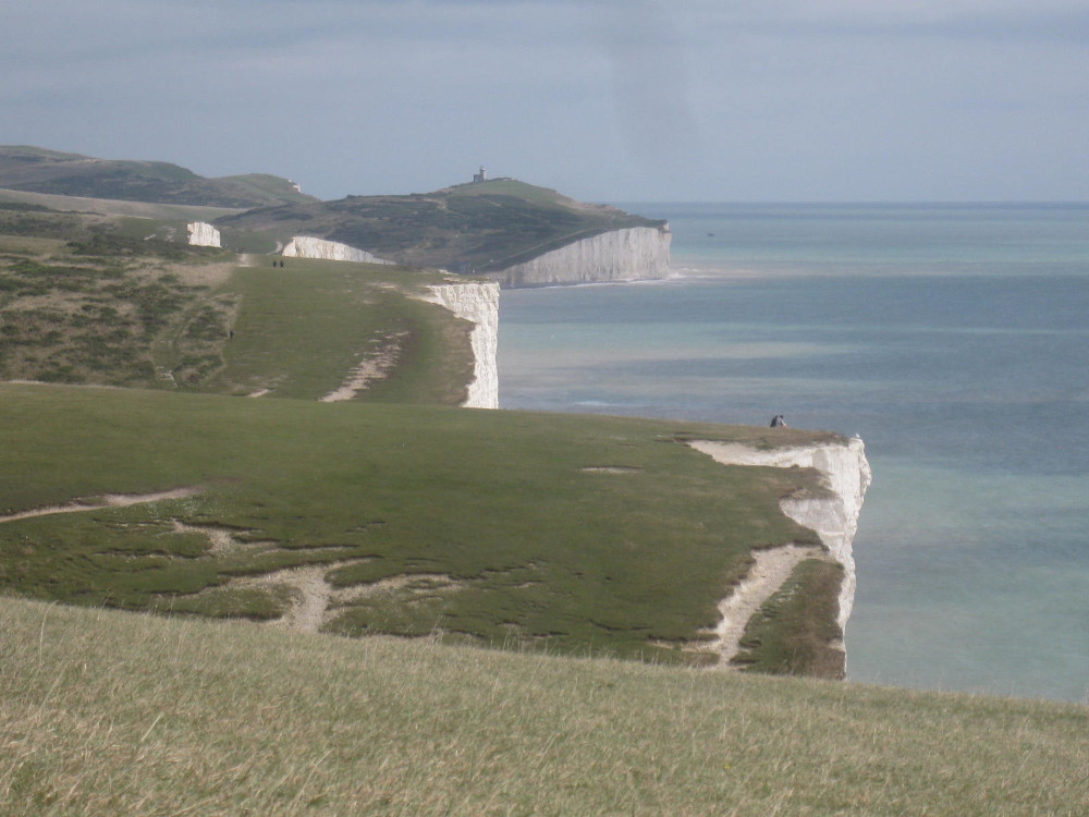
Walk 1: a 9km walk around the Pevensey Levels - extended by a couple of hours exploring inside Pevensey Castle (English Heritage, excellent audio tour).
Walk 2: a 15km hilly walk, starting from the car park in East Dean, out to Cuckmere Haven, and returning over the Severn Sisters.
Walk 3: a 16km walk around Sissinghurst, visiting Sissinghurst Castle (National Trust), starting from Cranbrook.
Walk 4: a 10km walk around "Mad Jack's Brightling Follies", starting from Brightling Down. Followed up by a quick tour of Batemans (Rudyard Kipling's house, National Trust).
Walk 5: a 15km walk around Ashdown Forest (the inspiration for 100 Acre Woods, in AA Milne's Pooh stories) including the original Poohsticks Bridge starting from Hartfield.
Walk 6: Bodiam Castle (National Trust) followed by an 8km walk in the locality.
Lots of other walks are available in the area - which also offers easy access to a number of other historic sites.
 Meeting at Pontypool Leisure Centre Car Park this was an 8/9 mile moderate walk with no serious climbs. The walk included canal, meadow, common and forestry trails.
We headed up to Penyrhoel village on to Cwm Lickey and Mynydd Twyn-glas before dropping down into Blaen Bran forest Upper Cwmbran.
Return was through Pontnewydd golf course returning eventually to the car park.
 A group of 8 members set off from Black Hill car park. The weather was sunny but surprisingly cool due to a strong breeze. We followed the pretty tree-lined path, with many fords running down over it, in a Northerly direction through the Craswall Valley towards Hay Bluff stopping for coffee along the way.
Towards the end of this path, we crossed some fields to pick up a wide track running to yet another, much wider ford, with little waterfalls. After crossing these, we continued uphill and across the common which eventually meets the car park at Hay Bluff. Here we took time out for lunch, tucking into the crevices of another ford as the wind was still quite cool even though the sun was strong.
We then took the steep path up onto Hay Bluff and along to the trig point hoping to get sight of a "monolith", resembling Cleopatra's Needle, that had appeared nearby early in the New Year. However, the monolith had disappeared even though some members of the Group had spotted it quite recently (pic from March here).
From here we picked up the return path heading South with views of the Craswall Valley on one side and the Olchon Valley on the other.
The wind had dropped and the weather was stunning as were the views so we had an "apple stop" to "soak it all up".
Finally, we picked our way down the rocky outcrops known as the Cat's Back to the cars below.
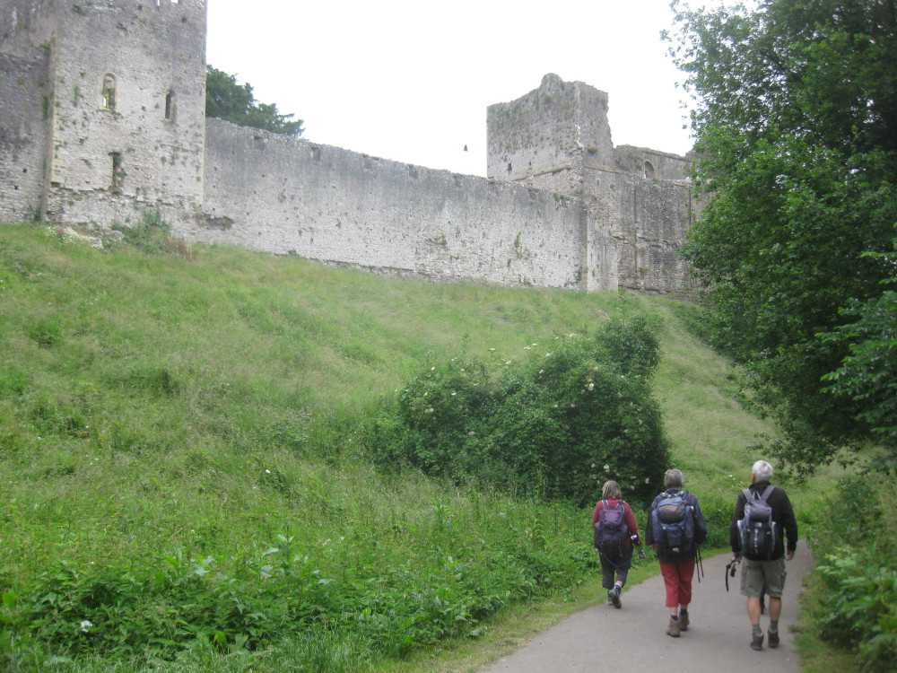 Walking from Chepstow Leisure Centre we walked through the grounds of Chepstow Castle, crossed the Wye bridge to reach the Offa's Dyke Path.
We walked north on the path to reach Wintour's leap which gave us a spectacular view of the Wye many feet below us.
We then turned south onto the Gloucestershire Way to reach the old railway track at Netherhope. This took us into Sedbury and onto the start of the Offa's Dyke Path where we lunched on the banks of the Severn.
Walking north once again we traced the Path back to Chepstow.
 A week's stay in Skipton Yorkshire, gave us beautiful walks in and around Wharfdale and Nidderdale and the surrounding areas.
This was our second visit to the area where we found plenty of varied walking to enjoy.
We walked to the high points of Simon's Seat and also Great Whernside.
Walking in the Dales gave us lovely scenery including raging rivers, waterfalls, canal-side walks, moorland walks, fantastic rock formations, limestone pavement scenery, and the ever present fields, barns and stone walls.
 A select group of four walkers set out from Stanton car park and walked through the Cotswold village, admiring the characteristic architecture of the cottages along the way. We continued on part of the Cotswold Way, pausing to watch a group of young farmers shearing sheep, and walked through Stanway, passing Stanway House with its magnificent gateway and glorious church, and pausing to look at Stanway Mill (open for milling on Thursday mornings!).
Then on through the hamlet of Wood Stanway and up onto the ridge of the Cotswolds, where we sat and admired the views over the Severn valley, enjoying a coffee break, only briefly interrupted by some inquisitive cows, one of which had an unusually coloured grey calf.
Our route then took us east, past what must be the largest stone quarry in the Cotswolds, and across the fields to Cutsdean, where we stopped to admire the well-preserved Victorian sheep dip and watched a local farmer feeding new-born lambs. Then on through Taddington and up onto the track towards Snowshill, with a view to Broadway Tower on the horizon. After a stop for lunch we dropped down into the village of Snowshill, passing the National Trust property Snowshill Manor.
Continuing on beyond the village we climbed up onto the Cotswold edge again and turned south along the Cotswold Way, finally dropping back down the slope to return to Stanton.
A glorious walk full of interest, in perfect walking weather.
 April's walk started from a layby in Edge End in the Forest of Dean.
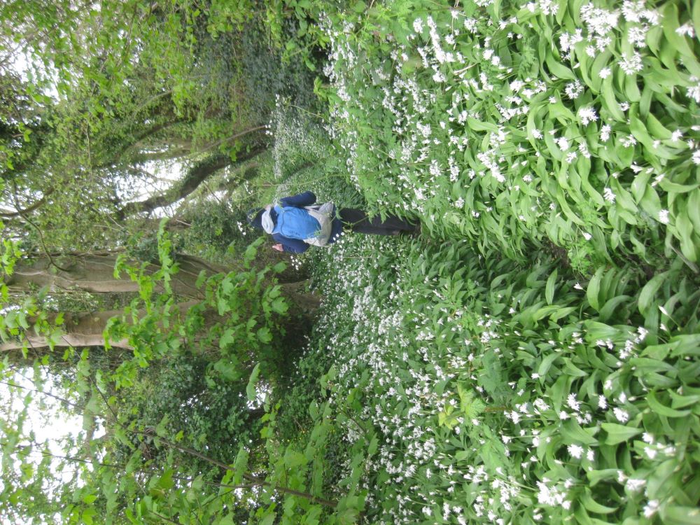
We walked down to the banks of the River Wye taking in English Bicknor on the way. From the Wye we walked up to Symond's Yat on winding path through banks of wild garlic.
Reaching the high point of the day there were lovely views of the Wye and the surrounding hills and valleys.
Walking back through English Bicknor the paths took us back to Edge End.
 A low-level walk through deciduous woodland and the riverside scenery of the Afon Pyrddin, Afon Nedd, Afon Mellte and Afon Hepste.
We started from Pontneddfechan, heading north and west via Pont Melin fach (the picnic site making for an excellent coffee stop despite the rain) and Hendre bolon, before heading south along the Afon Hepste and back to our starting point.
With the recent wet weather the rivers were in full flow; the walk behind the fall at Sgwd yr Eira was spectacular, and not a little wet.
 February’s walk started in the heart of the Forest of Dean at the carpark on the site of what had been Speculation coal mine and was set to visit the highest point of the Dean at Ruardean Hill at 290 metres above sea level.
We walked north on the disused railway line passing Mireystock Bridge and Mireystock Tunnel at 150 metres above sea level. After crossing the A4136 we soon started climbing through the trees to reach The Pludds where we enjoyed lovely views of the Wye Valley and Wales beyond. We then walked on emerging from the trees above the village of Ruardean.
The route then followed footpaths over fields to reach Ruardean Hill and the view point at Pan Todd at 290 metres above sea level. After looking at the memorials to miners killed in pit accidents, we ate our lunch looking over the views to the north including The Malvern Hills. From Ruardean Hill we walked to the village of Ruardean Woodside and then descending through the trees on a good track we reached a beaver enclosure.
Beavers were introduced into the area around Greathough Brook a few years ago and although we saw evidence of their handiwork, no beavers were spotted.
Re-crossing the A4136 we visited Waterloo Screens where there is a large lily-filled pond and a memorial to 182 miners and their cat who were underground when water flooded into the workings. All the miners and their cat were saved. From the memorial a short walk on the railway line brought us back to the carpark.
 Starting from the lower car park in Burrington Coombe we first walked through Mendip Lodge Woods and stopped briefly at the ruined remains of Mendip Lodge to talk about its history.
Continuing into the Dolebury Warren Woodland; we stopped at the 'Lookout' for an early coffee.
After coffee there was a steep climb up through the woods and on to Dolebury Warren Iron Age Hill Fort. Here it was clear that we had been sheltered from the winds, so we didn't stay long on the top.
We then walked back towards Black Down, turning right to follow the path through the edge of the woodland, stopping for lunch just before moving on to the open area of Black Down itself.
The forecast was for increasing wind and for what had been a dry day to turn very wet. There was an Amber warning for the winds from Storm Isha for the evening. We therefore took a shorter route over Black Down than planned (missing the trig-point) to return to the cars in time to get home before the worst of the rain hit.
 A damp start, eleven of us started from Monmouth climbing up the hill to Penalt Old Church.
This is where we should have had coffee and admired the view down the River Wye but with poor visibility, we continued, dropping down to the river and walked along to The Boat Inn. Luckily this was shut, so we took advantage of their covered seating area for our coffee.
Walked along side the river, fast flowing and brown. Another climb, through fields and wooded areas back to Penalt by which time the rain had stopped and we were able to sit on a convenient pile of logs for lunch.
Back down the hill to Monmouth with some clear views of the town and beyond.
Thank-you to our walk leader for the tea, mince pies and excellent cake afterwards.
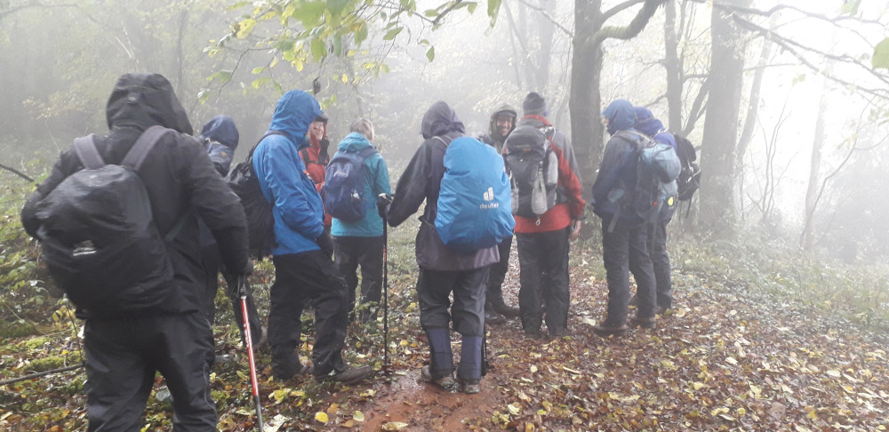 A wet day. 12 hardy souls met up at the Lower Wyndcliff Car Park on the A466 (between St Arvans & Tintern) on Remembrance Sunday. We climbed up through the woods (following the moderate route) to reach The Eagles Nest viewpoint which normally offers spectacular views over the river and across into parts of Gloucestershire and Somerset - sadly the view was reduced by the foggy conditions.
Leaving the viewpoint, we took a short detour from the main path to fix a memorial plaque to our founding member, who sadly passed away earlier in the year. After a short pause to reflect on his gift to us individually and, collectively to the club he helped to form in 1977, we continued back to the main path and continued heading north. We stopped again just before 11, in the shelter of the trees on the edge of the ancient hill fort, for a second act of remembrance.
We continued after coffee, dropping down towards Tintern, giving us views over the Abbey. We then turned away from Tintern, and stopped for lunch in the grounds of St Mary's Church (sadly destroyed by fire in 1977), with its collection of unusual tombstones and, poignantly given the date of our visit, a single Commonwealth War Grave.
After lunch, we began the second long climb of the day, passing Ponterry Church, to eventually reach the trig point (although we couldn't see it between the two radio masts, and the tangle of overgrown brambles).
We then returned to our cars, passing the now deserted Upper Wyndcliff car park on the way, reaching the cars in the gathering gloom, but just before the arrival of some heavy rain.
Thank-you to everyone who attended.
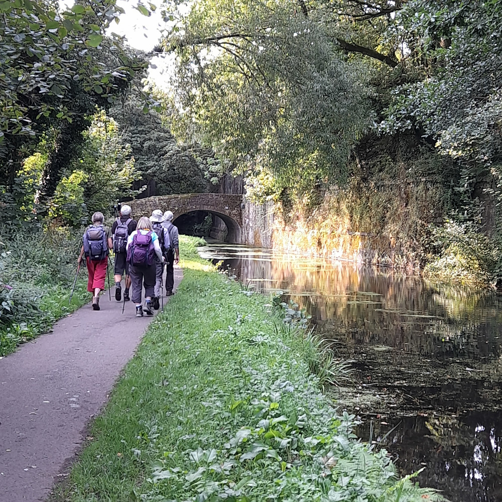
 A clash with the Stroud Half Marathon meant parking was more restricted at our meeting point at Ryeford (between Stroud and Stonehouse) than expected.
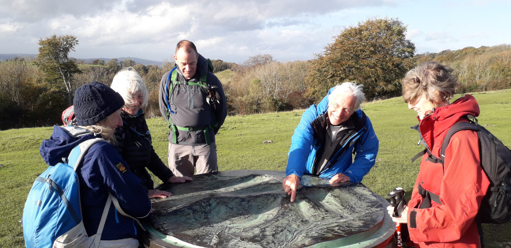
After a short delay, we set off along the Stroudwater Canal towpath. Then leaving the canal we headed uphill, skirting Stroud.
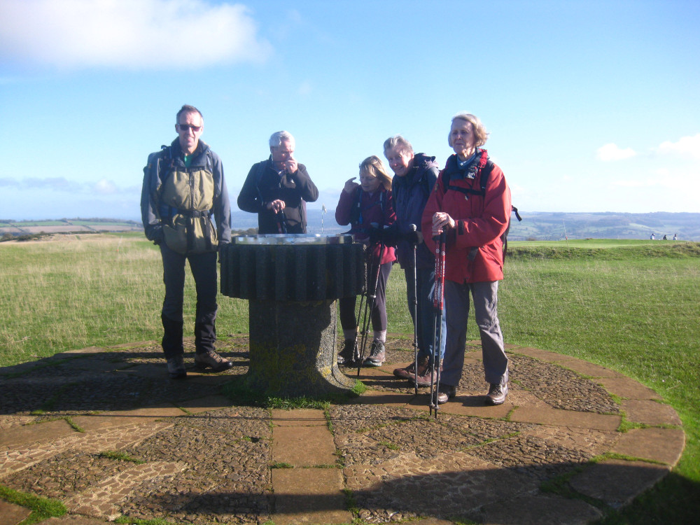
Once up on the higher ground we followed ome of the Cotswold Way to Haresfield Beacon (and its Topograph) and then descended back to the starting point at Ryeford.
A very enjoyable walk of about 9 miles, with some fantastic views across the Servern. We were fortunate to miss the showers, though we did see a rainbow over Gloucester. The only brief shower we had was after we had got back to the cars - perfect timing.
 An October week away, in The Lake District, staying in a 12-bed 'cottage' just south of Keswick.
Sadly the weather wasn't as kind as it might have been (a mini-heatwave the week before, being replaced by some unsettled weather, then followed, after our departure, by Storm Agnes). Despite this, we managed a variety of walks, including two from Little Town (both variants on the Newlands Round), Helvellyn via Striding and Swirral Edges from Glenridding and a walk from the 'cottage' taking in Castlerigg Stone Circle and Walla Crag.
We also included a trip to the Bowder Stone, and a walk from Honister Slate mine over Honister Hause to the top of Fleetwith Pike and back via the tramway. The wet-weather-day options included a trip around Grasmere including Loughrigg Terrace, a day shopping in Keswick and a walk around Latrigg.
Thanks to everyone who helped with the catering - which lived up to the normal standards.
Hopefully we'll be back with more trips away next year.
 On a very hot September day five walkers met in a layby on the A4136 Monmouth to Staunton road.
The walk started through woodland, walking up hill to reach open ground at Staunton Meend. From there it we walked downhill to the edge of Redbrook before taking paths across the fields to Newland.
After looking round the lovely church we then walked down Savage Hill into the valley before climbing steeply up the Offa’s Dyke Path.
We then walked into Redbrook before tackling the very steep and long climb to the Kymin where there were lovely views over Monmouth and the Black Mountains.
From the Kymin it was an easy stroll back to the cars.
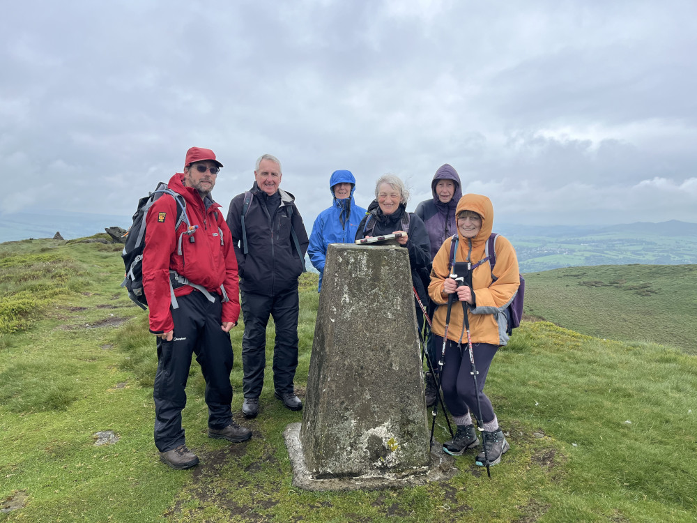
![]() 11 walkers gathered at the surprisingly popular Grwyne Fawr Reservoir (upper) car park – several having been slightly delayed by a small flock of sheep that had escaped onto the only access road to the car park and then seemed very reluctant to leave the road…
11 walkers gathered at the surprisingly popular Grwyne Fawr Reservoir (upper) car park – several having been slightly delayed by a small flock of sheep that had escaped onto the only access road to the car park and then seemed very reluctant to leave the road…
The group set off on the usual route up towards the Blacksmiths Anvil stone on the eastern ridge – although this time we bypassed it. We continued in a NE direction along the ridge, stopping for an extended coffee stop (and several flora related discussions) along the way to the trig point at the head of the valley.
We then continued in a SE direction to reach the old ‘Constables Route’ byway that crosses the ridge – where we had an ‘almost sheltered' lunch break before the major decision of the day.
After a brief discussion, the group continued with the longer, higher-level route over Pen y Manllwyn, Waun Fach and Pen y Gadair Fawr, where we turned North East, and began the steep descent back down into the valley. We then crossed a minor tributary before following the main stream downstream to the conveniently located footbridge which brought us back to the car park.
Our walk provided a complete circuit around the reservoir, with views of the reservoir and the surrounding countryside, most spectacularly the view NW from the head of the valley, down the escarpment towards mid Wales.
GPS recorded figures: 18km with 550m ascent (or 12miles with 1800’ ascent).
 From the school car park we looped round to cross the river and the walk up to join the canal. The heavy shower stopped just in time for coffee sitting by the canal.
After a break we climbed up a series of roads and tracks until we had some fantastic views across the valley for our lunch break.
The more gradual descent after lunch took us back to the canal via the vilage of Ffawyddog. We then walked along the canal past the limekilns and the marina before returning to Crickhowell after admiring a very tall Redwood Tree.
There were just a few drops of rain as we got back to the river, but not enough to leave us with wet clothes. A very enjoyable 10 miles.
 On a rather misty morning which obscured the views into the Wye Valley we set off from Whitestones car park near Llandogo.
Climbing steadily through the lovely woodland carpeted with bluebells, we arrived at Cleddon Falls. From the falls more climbing brought us to Beason Hill where there were hazy views towards Sugarloaf and the Black Mountains.
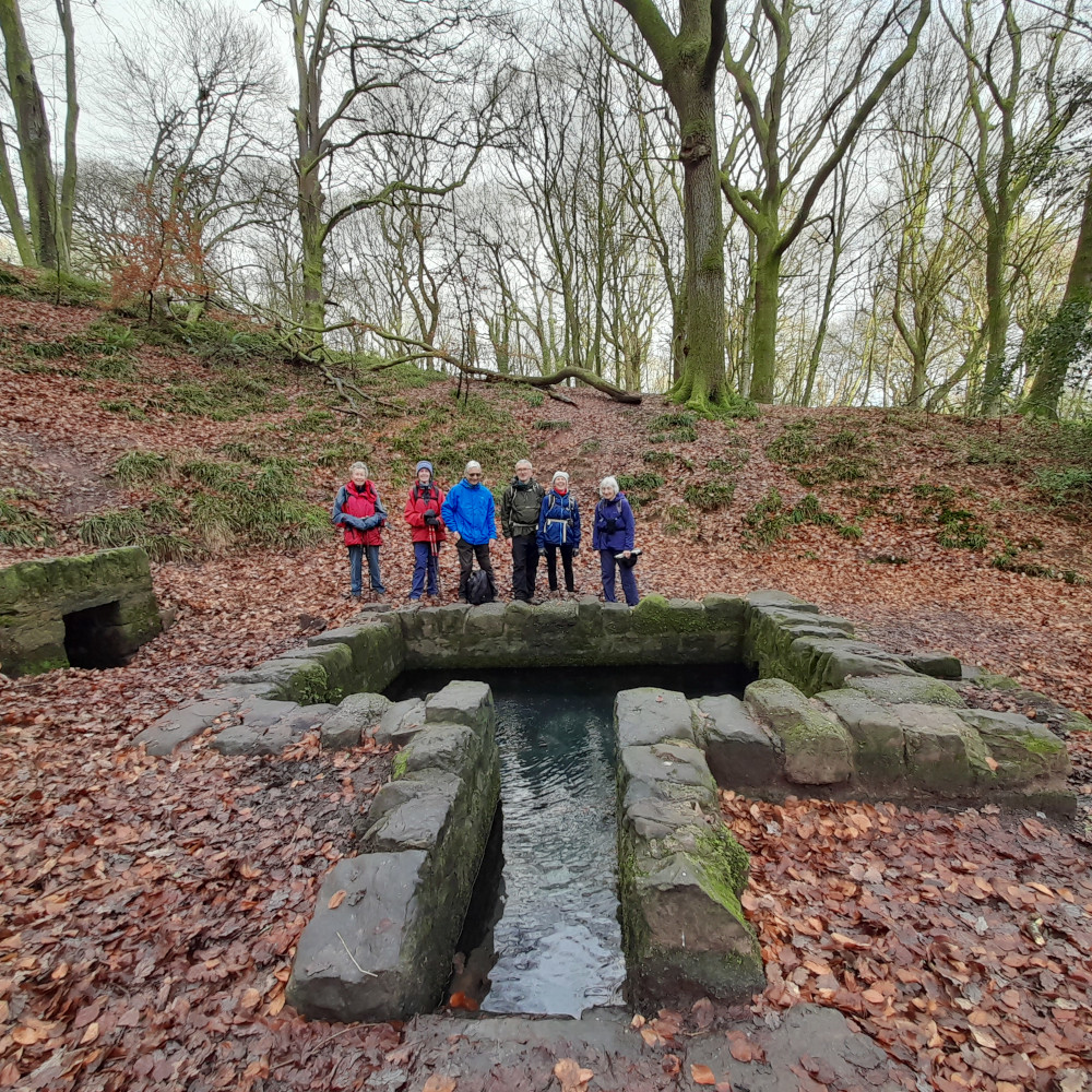
Walking downhill we reached Trellech and visited The Virtuous Well. Walking through to Catbrook and more woodland brought us back to the ca park.
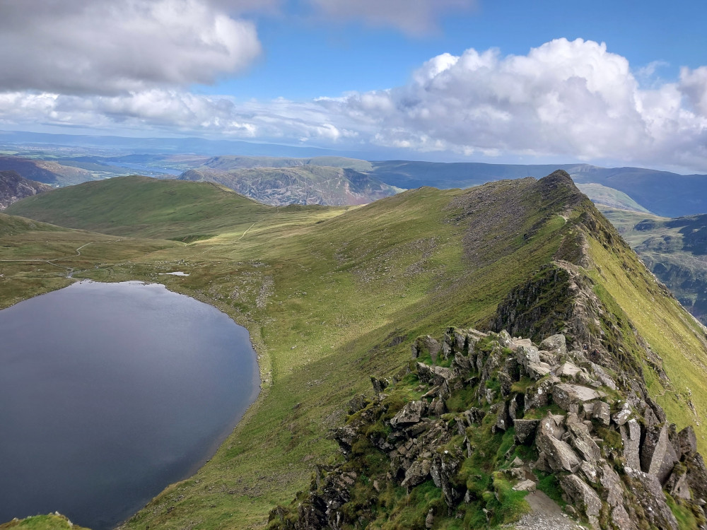
 A fine route into the most westerly of the northern Brecons valleys, following the river upstream, passing several impressive waterfalls before ascending to Corn Du via the lake of Llyn Cwm Llwch.
From there, we crossed over onto Pen y Fan before heading back northwards following the ridge of Cefn Cwm Llwch.
Visibility was limited by low cloud, while the rain of the previous few days ensured muddy conditions underfoot (and wet feet for few on the final river crossing before arriving back at the car park) but the rain stayed away and overall this was another enjoyable day in the hills.
 Meeting at Chepstow Leisure Centre, February’s walk took into the countryside surrounding the town.
From the Leisure Centre we walk past the Racecourse and the imposing ruins of Piercefield House. Entering the woods we walked the Wye Valley Walk to the viewpoint and carpark on the Chepstow to Tintern Road.
Crossing the road we walked through more woodland to reach Porthcasseg and from there walking over fields to reach St. Mary’s Church at Penterry.
A short walk brought us to Gaer Hill the highest point of the day with far-reaching views over the Wye and Severn. We then descended to St. Arvens and found our way back to Chepstow via Fedw Wood, Barnet’s Wood and Bayfield.
 No snow, but the River Avon was in flood after a very wet week, so the route had to be altered to avoid the riverside path.
We walked across Dundridge Park and then up to Panorama Walk with views to the flooded Eastwood Farm. Having walked down the '100 steps' we then followed high level paths through the woods above the river, taking our coffee break sheltering from one of the day's regular showers under the Avon Ring Road bridge.
We then crossed the river via the bridge and crossed the fields to Ironmould Lane. With the water meadows flooded we walked around the top section of Eastwood Farm and then across Brislington Meadows to Victory Park for lunch.
After lunch, we followed Brislington Brook, through Nightingale Valley and St Anne's Wood before returning to Crew's Hole along the river path with the river lapping at the path edges.